
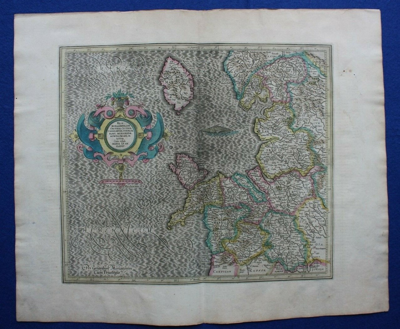
Antique atlas map NORTH WEST ENGLAND, NORTH WALES, ISLE OF MAN, Mercator, c.1613
175,00 GBP175,00 GBP
mar., mai 13, 04:35 PMmar., mai 13, 04:35 PM
Photo 1 sur 8


Galerie
Photo 1 sur 8


Vous en avez un à vendre?
Antique atlas map NORTH WEST ENGLAND, NORTH WALES, ISLE OF MAN, Mercator, c.1613

175,00 GBP
Environ320,24 $C
ou Offre directe
État :
“Very good condition. Light age toning with one or two darker age spots / handling marks to the right ”... En savoir plussur l'état
Oops! Looks like we're having trouble connecting to our server.
Refresh your browser window to try again.
Expédition :
9,50 GBP (environ 17,38 $C) Royal Mail International Tracked.
Les objets provenant de l'étranger pourraient faire l'objet de frais d'administration douanière et de frais supplémentaires.
Lieu : Ilkley, Royaume-Uni
Livraison :
Livraison prévue entre le mar. 5 août et le mer. 13 août à 94104
Renvois :
Renvoi sous 30 jours. L'acheteur paie les frais de renvoi. Si vous utilisez une étiquette d'envoi eBay, son coût sera déduit du montant de votre remboursement.
Paiements :
Magasinez en toute confiance
Le vendeur assume l'entière responsabilité de cette annonce.
Numéro de l'objet eBay :335838366971
Caractéristiques de l'objet
- Remarques du vendeur
- Cartographer/Publisher
- Gerard Mercator
- Printing Technique
- Copper Plate
- Date Range
- 1600-1699
- Original/Reproduction
- Antique Original
- Country/Region
- Isle of Man, England, Wales
- Era
- 1600s
- Format
- Atlas Map
- Type
- Topographical Map
- Year
- c.1613
Description de l'objet du vendeur
À propos de ce vendeur

Maps etc. Antique Maps & Prints
100% d'évaluations positives•5,6K objets vendus
Évaluations comme vendeur (2 527)
Cet objet (1)
Tous les objets (2 527)
- eBay automated Feedback- Évaluation laissée par l'acheteur.Six derniers moisOrder completed successfully – tracked and on time
- e***a (70)- Évaluation laissée par l'acheteur.Six derniers moisAchat vérifiéI am giving this purchase a 5-star rating, even though the map arrived more than a month late & the shipping tube had been severely mangled (no damage to the contents). Neither problem was the Seller's fault. The shipment was held by US Customs for a month (visible on the tracking documents) without explanation or contact. Seller remained in regular contact, offered to, and then refunded full purchase price during this hiatus. Upon successful delivery, Seller re-invoiced for the map, & I paid.Original antique atlas map BRITISH ISLES, GREAT BRITAIN, IRELAND, E Bowen, 1747 (#335916077525)
- 1***1 (698)- Évaluation laissée par l'acheteur.Dernier moisAchat vérifiéReceived very quickly and well packaged. Item as described, excellent seller.
- r***o (2729)- Évaluation laissée par l'acheteur.Dernière annéeAchat vérifiéGreat Seller - This map arrived exactly as described it will be a great addition for my Ancestry research. The map arrived very well packaged and rolled carefully and placed into a postal tube. The delivery was well within the estimated time. I would have no hesitation in recommending this seller to any potential buyers - THANK YOU.PLYMOUTH, DEVONPORT, CITY PLAN, STREET PLAN, original antique map, Bacon, 1884 (#235500514934)